MTB Touren
 English
 Italiano
 Deutsch
Routenbeschreibung
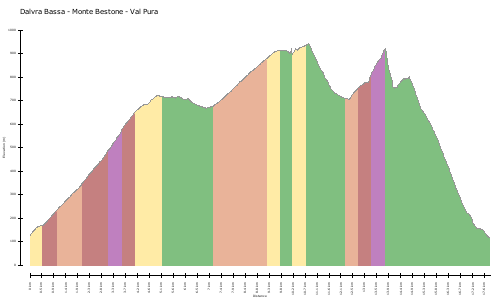
Prima di Limone, preso l'incrocio che conduce a Vesio, lasciamo l'auto in un parcheggio sulla dx; si riprende la Gardesana fino alla fine dell'ultima galleria prima di Riva (ricordarsi la pila per farsi vedere!); prendiamo sulla sx la strada del Ponale che con spettacolare salita sale costante ma mai difficile: i panorami meriterebbero una sosta ogni svolta. Alla fine del tracciato, ci immettiamo con inversione a sx sulla strada che porta a Pregasina dove alla fontana del paese facciamo l'ultimo rifornimento idrico possibile; prendiamo la rampa di fronte alla fontana: la salita è costante e in buona pendenza fino alla Bocca Larici (907 mt); consigliata la deviazione di 3 min. sulla sx per ammirare unici panorami a strapiombo sul lago. Si prosegue sempre in salita fino ad una baita che lasceremo sulla sx; la strada dopo una breve discesa incrocia con il sentiero che conduce al Passo delle Rocchette(vedi cartello e foto): inversione a sx brusca e....chi dirà di non essere mai sceso da sella, sarà un bugiardo! Sentiero difficile e duro per circa 30 min fino al Passo (mt 1100); si prosegue a dx dopo sbarra in veloce e scivolosa (all'inizio) discesa seguita da altra rampa piuttosto snervante; il sentiero poi è in quota con leggeri saliscendi che ci condurranno fino al rifugio del Passo Nota (mt 1299). Per scendere si può prendere la variante alta che attraverso gallerie e discesa (sterrata e piacevole) ci riporterà a Limone oppure (vedi traccia) la poco onorevole strada asfaltata che rapidamente conduce a Vesio e poi a Limone. prima di Limone, prendere bivio a sx verso vesio-tremosine; dopo 500 mt sulla dx parcheggio.
http://itinerari.mtb-forum.it/tours/view/7709
Before Lemon, took the crossroad that leads to Vesio, leave the car in a parking lot on the right; resumes Gardesana until the end of the last tunnel before Riva (remember the stack to be seen!) take the road on the left with a spectacular climb that Ponale salt constant but never difficult: the views deserve a break every turn. At the end of the track, we put the reversing left on the road that leads to the fountain of the country where Pregasina do the last possible water supply; take the ramp in front of the fountain: the ascent is steady and in good slope to Mouth Larches (907 mt); Recommended deviation of 3 min. on the left to see unique views overlooking the lake. Keep going uphill to a cabin that will leave you on the left; the road after a short descent crosses the path that leads to the Pass of rocchette (see the sign and photos): abrupt reversal to the left .... and whosoever shall say to never be dropped from the saddle, it will be a liar! Path difficult and hard for about 30 min until Step (mt 1100); continue right after the bar in fast and slippery (top) down followed by another ramp rather unnerving; then the path is in proportion with slight ups and downs that will lead us to the refuge of the Passo Nota (1299 mt). To get out you can take the alternative route through tunnels and down (dirt and pleasant) take us back to Limone or (see track) the dishonorable paved road that quickly leads to Vesio and then to Limone. before Lemon, take left fork towards Vesio-tremosine; after 500 meters on the right parking lot.
http://itinerari.mtb-forum.it/tours/view/7709
Karte/Höhenprofil
Bilder