MTB Touren
 English
 Italiano
 Deutsch
Routenbeschreibung
Von Malchesene mit Fähre nach Limone dann rauf zum Pasa Nota und wieder runter RichtungRiva. Von da aus entweder mit Fähre oder wie wir über Haupstraße / Radweg am See zurück nach Malchesene .
http://www.gps-tour.info/en/tracks/detail.68747.html
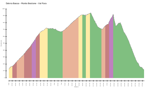
Karte/Höhenprofil
Bilder