Percorsi MTB
 English
 Italiano
 Deutsch
Descrizione del percorso
Die Auffahrt zum Tremalzo führ hier nicht wie bei den meisten Touren über den Ledrosee sondern von Limone aus über Vesio und den San Michele Stausee hoch zum Tremalzo. Von Limone bis Vesio gehts auf Teerstraße hoch danach weiter auf Schotter. Hier kurbelt man Stück für Stück bis hoch zum Pass. Auch die Anstrengende Auffahrt wartet mit tollen Panoramen auf. Man kommt am kleinen aber schönen San Michele Stausee vorbei und später noch an einem schönen Wasserfall des San Michele. Zur Tremalzo Abfahrt brauch ich wohl nicht viel schreiben. Sollte ja bekannt sein. Wir sind bis zum Passo Nota gefahren und dort dann rechts weiter auf dem 206 am Coma Vecchia vorbei bis nach Vesio. Der 206 macht genauso viel Spaß wie die Schotterabfahrt vom Tremalzo und weist zudem noch ein paar Trailpassagen auf Von Vesio bis nach Limone sind wir den gleichen Weg runter gefahren wie zu Beginn rauf. Ist zwar Teerstraße, macht jedoch auf Spaß mit Highspeed bergab zu fahren. Viel Spaß beim Nachfahren!
The driveway to Tremalzo not recirculation here as with most trips across the Lake Ledro but from Limone Vesio and the San Michele reservoir up to the Tremalzo. From lime to Vesio go on tar road up then continue on gravel. Here boosts you bit by bit to high to pass. The Strenuous driveway waiting for their spectacular views. You will pass the small but beautiful San Michele reservoir and later. Still on a beautiful waterfall of San Michele To Tremalzo departure, I probably need not write much. Was supposed to be known. We went to Passo Nota and there then right onto the 206 at Coma Vecchia past to Vesio. The 206 makes just as much fun as the gravel descent from Tremalzo and yet also has a few trail sections on From Vesio to Limone we went down the same path as the beginning up. Although being tarred road, but makes for fun with High Speed ??to drive downhill. Enjoy your descendants!
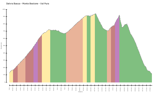
Mappa/Altimetria
Immagini