×
Login
Username
Password
Keep me logged in (for 2 weeks)
MTB Touren
Toggle navigation
Home
Map
Search
About
English
Italiano
Deutsch
Sign in
×
Close
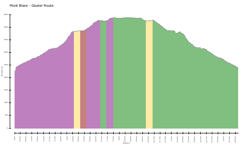
Mont Blanc
1127
63
19.8 km
Distance
2729 m
Elevation Gain
3241 m
Elevation Loss
4813 m
Max height
1819 m
Min height
Road
Equip
Skill
Effort
Routenbeschreibung
Translate
Original
No description available for this track. Help us, write something!
No description available for this track. Help us, write something!
Karte/Höhenprofil
Bilder
Upload photo
Download GPS Datei
GPS Datei herunterladen
Download
GPX
KML
TCX
Gesamte Seite für späteren Ausdruck herunterladen
Download
PDF
Suggested trails nearby
Mont Blanc - Gouter Route
19.8 km
2305 m
Mont Blanc 2014
15.6 km
2056 m
Aborted walk up Mont Blanc
7.1 km
897 m
Nide d' aigle
6.4 km
428 m
Other tracks nearby...
‹
›
×
×
Report track #102490
Inappropriate/wrong Title, Description or Characteristic
Inappropriate/wrong Photo or it violates a Copyright
Spam or inappropriate Comment
Track is duplicated or too similar to others
Other issue (Please leave some additional comments)
Additional comment
Contact E-mail (Optional, a notification will be sent when the issue is closed)
Close
Report
 MTB Touren
 English
 Italiano
 Deutsch